The Indian River Lagoon at Titusville: ecology, impairment, and recovery efforts
The Indian River Lagoon system is North America's most biodiverse estuary. At Titusville's latitude it's also one of the most impaired, with documented seagrass loss and recurring algal blooms.
The Indian River Lagoon is a 156-mile shallow estuary stretching from Ponce Inlet (near Daytona Beach) south to Jupiter Inlet, with multiple sub-systems including the Banana River, the Mosquito Lagoon, and the Indian River proper. At Titusville’s latitude it sits between the mainland and the southern Mosquito Lagoon barrier-island spit. The lagoon is one of the most biologically diverse estuaries in North America, with over 4,000 species documented including 1,300+ plant species, 700+ fish species, and 300+ bird species. It’s also, since the early 2010s, one of the most ecologically impaired estuaries in the United States.
The Indian River Lagoon Council, established under the federal National Estuary Program in 1990, coordinates monitoring and restoration. The St. Johns River Water Management District runs the regulatory and water-quality monitoring program. Florida Fish and Wildlife Conservation Commission maps seagrass coverage and tracks species populations.
What the lagoon is, ecologically
The lagoon is shallow (mean depth roughly 3–4 feet, maximum depth in dredged channels closer to 10 feet), brackish (salinity varies seasonally and by inlet proximity, generally ranging from estuarine 5 ppt to near-marine 35 ppt at inlet vicinities), and relatively low-energy (limited tidal range, no river discharge of consequence except small tributaries on the mainland side, and protection from oceanic energy by the barrier islands).
That combination of shallowness, low energy, and brackish water creates exceptional habitat for seagrass beds (which need light penetration to the bottom), shellfish (oyster reefs in particular), and a fish community that includes both estuary-resident species (red drum, snook, spotted seatrout) and species that use the lagoon as a juvenile nursery before moving to the ocean (snook, tarpon, several reef fish species).
At Titusville’s latitude the lagoon is at its northern extent for some species and southern extent for others. The transition zone produces unusually high species richness.
The impairment
Through the 1990s and 2000s the lagoon experienced documented declines in water clarity, seagrass coverage, and fish populations. The drivers were a combination of:
- Nutrient loading from septic systems. Brevard County’s mainland-side residential development through the 20th century built out with extensive septic systems on lots draining toward the lagoon. Nitrogen and phosphorus loading from those septics contributed to algal blooms that reduced light penetration.
- Stormwater runoff. Pre-1990s development patterns had limited stormwater treatment; runoff from residential and commercial areas brought nutrients, sediments, and pollutants directly into the lagoon.
- Muck accumulation. Decades of accumulated organic sediment in lagoon-bottom areas created anoxic conditions and persistent nutrient cycling.
- Habitat loss. Bulkheading, dock construction, and shoreline modification eliminated much of the natural mangrove-and-marsh interface that had previously filtered runoff and stabilized sediments.
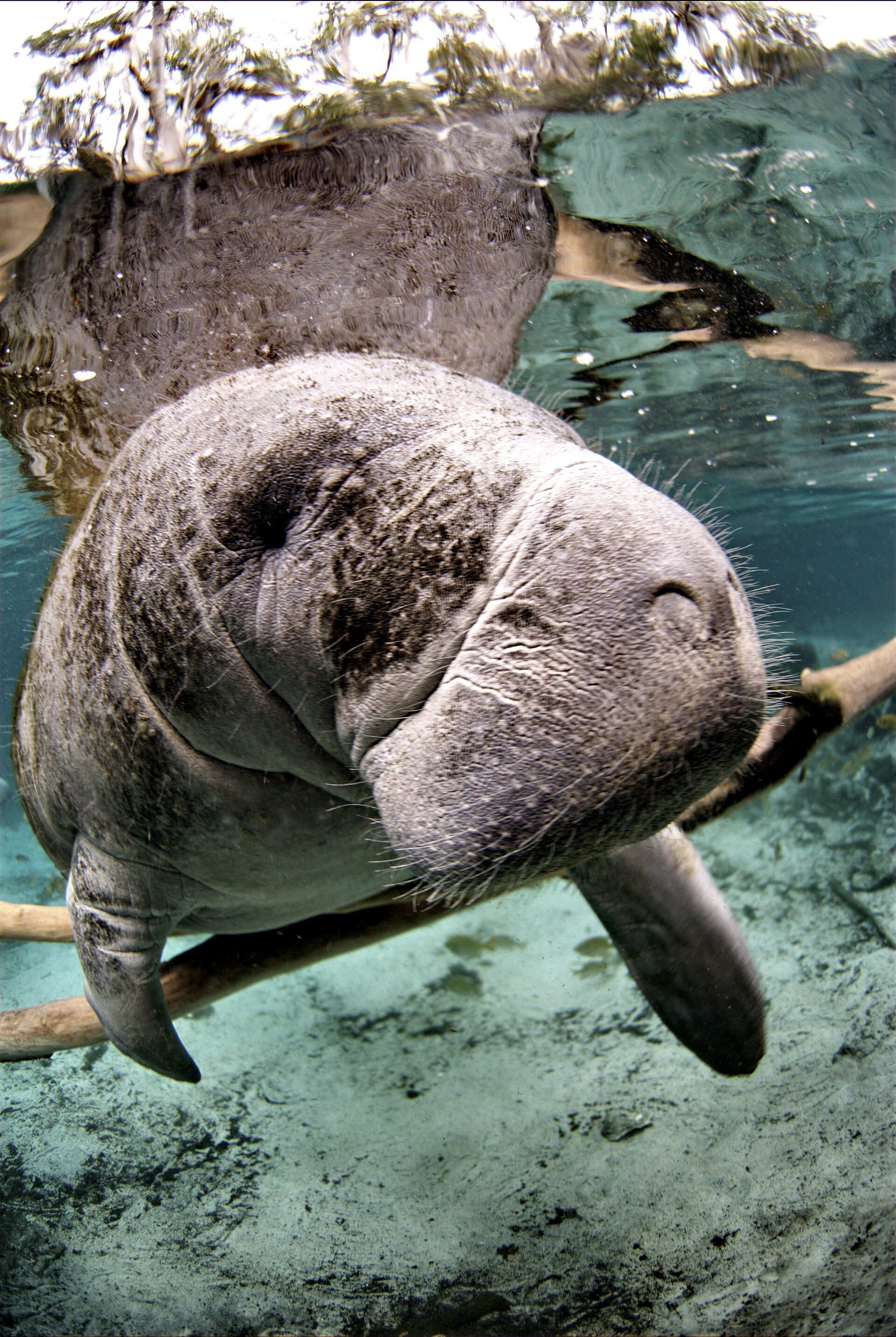
The cumulative effect was the 2011 superbloom, a sustained algal bloom that produced massive seagrass loss across the lagoon’s northern reaches. Seagrass coverage in the Mosquito Lagoon and northern Indian River dropped by over 60% from 2009 to 2013. Fish populations followed, with manatee deaths spiking in 2013 (UMEs, “unusual mortality events,” declared by NOAA) and again severely in 2021.
The 2021 manatee mortality event
The 2021 manatee deaths concentrated in the Indian River Lagoon’s northern reaches, including the waters off Titusville. Manatees feed primarily on seagrass; the seagrass die-off after 2011 left the lagoon’s manatee population without adequate forage. Florida Fish and Wildlife Conservation Commission and Florida Power and Light (which operated the long-running winter manatee refuge at Cape Canaveral) coordinated an emergency supplemental-feeding program at the FPL site through the winter of 2021–22.
The program, feeding manatees lettuce delivered by truck to the FPL warm-water discharge area, was successful in reducing acute starvation deaths but represented an extraordinary acknowledgment of how degraded the lagoon’s natural foraging conditions had become. The program ran in modified form for several subsequent winters.
Restoration efforts
The Indian River Lagoon Council and the St. Johns River Water Management District have coordinated a multi-billion-dollar restoration program through the 2010s and 2020s. Major components:
- Septic-to-sewer conversions. Brevard County and Titusville have committed substantial capital to converting older residential areas from septic systems to sewer connection. The state has provided matching funds.
- Stormwater treatment. New stormwater retention and treatment systems have been built across the watershed, capturing nutrients before they reach the lagoon.
- Muck dredging. Targeted dredging of high-organic-load lagoon-bottom sediments has been performed at multiple sites since the mid-2010s.
- Seagrass restoration. Active replanting programs run by FWC and university research partners (the Florida Institute of Technology and University of Central Florida in particular) have attempted to re-establish seagrass beds in pilot areas.
Results have been mixed. Some restoration sites show measurable recovery; the lagoon-system-wide recovery has been slow. Water clarity and seagrass coverage as of the early 2020s are still well below 1990s baselines.
Titusville’s relationship to the lagoon
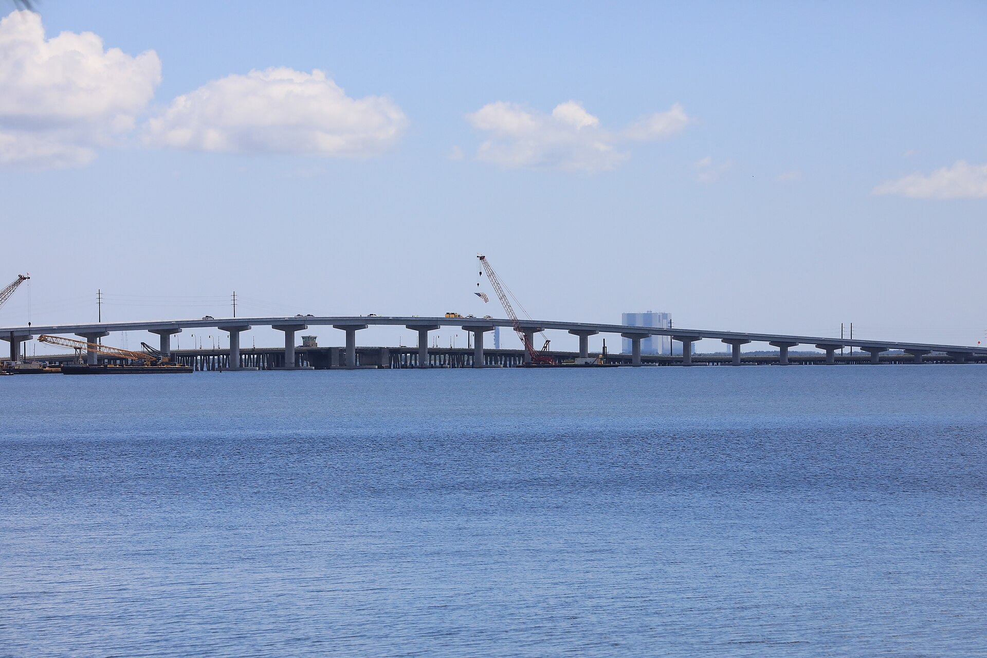
The city of Titusville sits on the lagoon. The Indian River bluff that Henry Titus built his hotel on is the same bluff Space View Park sits on; the city’s waterfront, its public parks, its boat ramps, its launch-viewing infrastructure all front on the lagoon. The city’s stormwater system drains to the lagoon. Many of the older residential neighborhoods on septic systems are within the lagoon’s watershed.
The city has been an active participant in the restoration program. Titusville voters approved a half-cent sales-tax extension in 2016 for “Save Our Lagoon” funding, which has gone toward septic-to-sewer conversions in city neighborhoods and toward stormwater infrastructure upgrades.
The 1990 Indian River Lagoon Act
The lagoon’s regulatory baseline starts with the 1990 Indian River Lagoon Act, a Florida statute that required all sewage treatment plants discharging to the lagoon to cease their lagoon discharges by 1996. The plants either upgraded to deep-well injection, advanced wastewater treatment with reuse, or closed and rerouted to upland treatment facilities. The compliance deadline was met by the major facilities, with substantial state and federal funding supporting the upgrades.
The act addressed point-source pollution effectively. It did not address the non-point sources, septic systems, lawn fertilizer, stormwater, that have driven the lagoon’s continued impairment. Per the Indian River Lagoon Council’s documentation, the post-1996 nitrogen and phosphorus loading from non-point sources roughly tripled the load from the pre-1990 sewage discharges, even as point-source loading went to near-zero. The 2011 superbloom traces to that cumulative non-point load, not to any failure of the 1990 Act’s point-source program.
The current restoration program, the multi-billion-dollar Save Our Lagoon and equivalent state programs, is in effect the second-generation Indian River Lagoon Act. Where the 1990 program targeted the visible smokestack-equivalent point sources, the 2010s and 2020s program targets the diffuse residential and commercial sources that produced the slower-acting, ultimately more damaging cumulative load. The 1990 framework remains the legal foundation; the actual restoration work is the second-stage build on top of it.
What the recovery looks like in practice
For a Titusville resident walking the Space View Park waterfront in 2026, the lagoon looks different than it did in 1990. Water clarity is worse on average. Seagrass that was visible from the bridges in the 1990s is largely absent now. Manatee sightings, once routine in the lagoon’s deeper channels, are less common.
The recovery program has measurable wins, specific lagoon-segment improvements, restored seagrass plots that have held, reductions in nutrient loading from completed septic-to-sewer projects. The lagoon-wide recovery is still incomplete. The 2010s impairment is, in ecological terms, recent enough that full recovery (if it comes) will take decades.
The Indian River Lagoon at Titusville is a working laboratory for what late-20th-century coastal development cost the estuary, and for what 21st-century investment can recover. Both stories are still unfolding.
Further Reading
As an Amazon Associate we earn from qualifying purchases.